 Add to Chrome
 Add to Firefox
 Add to Edge
Vincent Gauthier
Impact of natural disasters on consumer behavior: case of the 2017 El Nino phenomenon in Peru
Aug 11, 2020
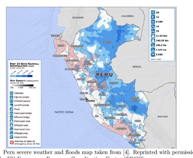
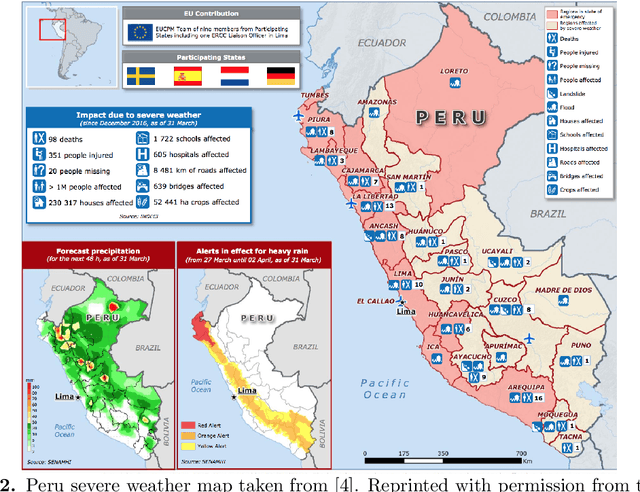
El Nino is an extreme weather event featuring unusual warming of surface waters in the eastern equatorial Pacific Ocean. This phenomenon is characterized by heavy rains and floods that negatively affect the economic activities of the impacted areas. Understanding how this phenomenon influences consumption behavior at different granularity levels is essential for recommending strategies to normalize the situation. With this aim, we performed a multi-scale analysis of data associated with bank transactions involving credit and debit cards. Our findings can be summarized into two main results: Coarse-grained analysis reveals the presence of the El Ni\~no phenomenon and the recovery time in a given territory, while fine-grained analysis demonstrates a change in individuals' purchasing patterns and in merchant relevance as a consequence of the climatic event. The results also indicate that society successfully withstood the natural disaster owing to the economic structure built over time. In this study, we present a new method that may be useful for better characterizing future extreme events.
CT-Mapper: Mapping Sparse Multimodal Cellular Trajectories using a Multilayer Transportation Network
Apr 22, 2016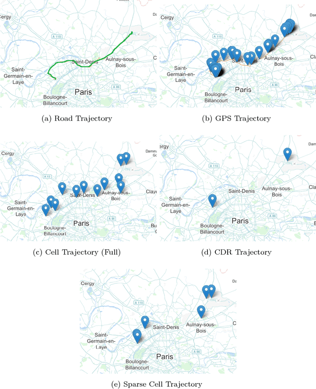
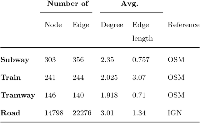
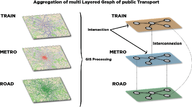
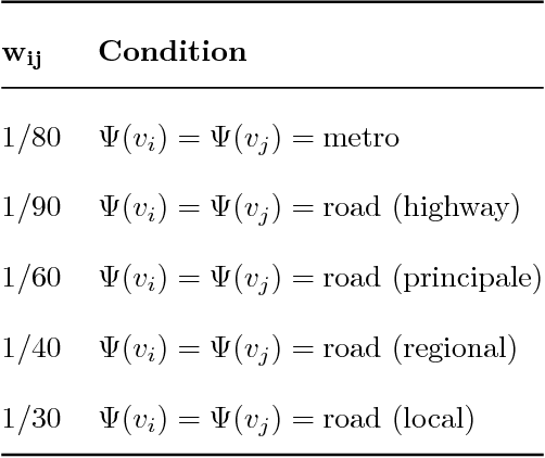
Mobile phone data have recently become an attractive source of information about mobility behavior. Since cell phone data can be captured in a passive way for a large user population, they can be harnessed to collect well-sampled mobility information. In this paper, we propose CT-Mapper, an unsupervised algorithm that enables the mapping of mobile phone traces over a multimodal transport network. One of the main strengths of CT-Mapper is its capability to map noisy sparse cellular multimodal trajectories over a multilayer transportation network where the layers have different physical properties and not only to map trajectories associated with a single layer. Such a network is modeled by a large multilayer graph in which the nodes correspond to metro/train stations or road intersections and edges correspond to connections between them. The mapping problem is modeled by an unsupervised HMM where the observations correspond to sparse user mobile trajectories and the hidden states to the multilayer graph nodes. The HMM is unsupervised as the transition and emission probabilities are inferred using respectively the physical transportation properties and the information on the spatial coverage of antenna base stations. To evaluate CT-Mapper we collected cellular traces with their corresponding GPS trajectories for a group of volunteer users in Paris and vicinity (France). We show that CT-Mapper is able to accurately retrieve the real cell phone user paths despite the sparsity of the observed trace trajectories. Furthermore our transition probability model is up to 20% more accurate than other naive models.